You took the long drive out to Tenaja, CA. You passed the fancy horse ranch on the tight one way road and you plowed right over the cattle guard in the road. You pulled in to the first parking lot because you figured the adventure to the trail head couldn’t be any more difficult than that. If you read the sign, realized your mistake, jumped back in your car and took the 5mile winding, decaying, and a bit dangerous road to the RIGHT Tenaja Trail Head, congratulations and for those that kept walking, this blog is for you……
From the parking lot at the Tenaja Trail head to Tenaja Falls you’re looking at 7.5 miles and 7.5 miles back. The way you read the ALLTRAILS info, you’re expecting a 1.5 mile hike round trip. You’ve seen the pictures so you know its beautiful and fairly easy to get to.
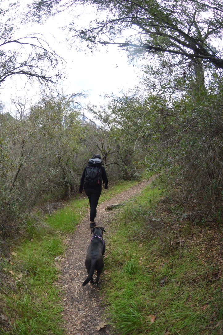
You quickly find yourself descending into a valley and the terrain goes from desert to forest fairly quickly. You’re excited about your adventure further as you begin to hear the sounds of running water. You’ve reached the first water crossing, and that matches up to the step by step directions you’ve read on socalhiker.
The trail is beautiful as it swiftly moves through tall grass, then through walnut trees, then up a hill where you expect to get your first glimpse of the beautiful 150′ tear drop falls. Theres nothing to see from this angle for some reason, but you hear the running water and you know the falls are close.
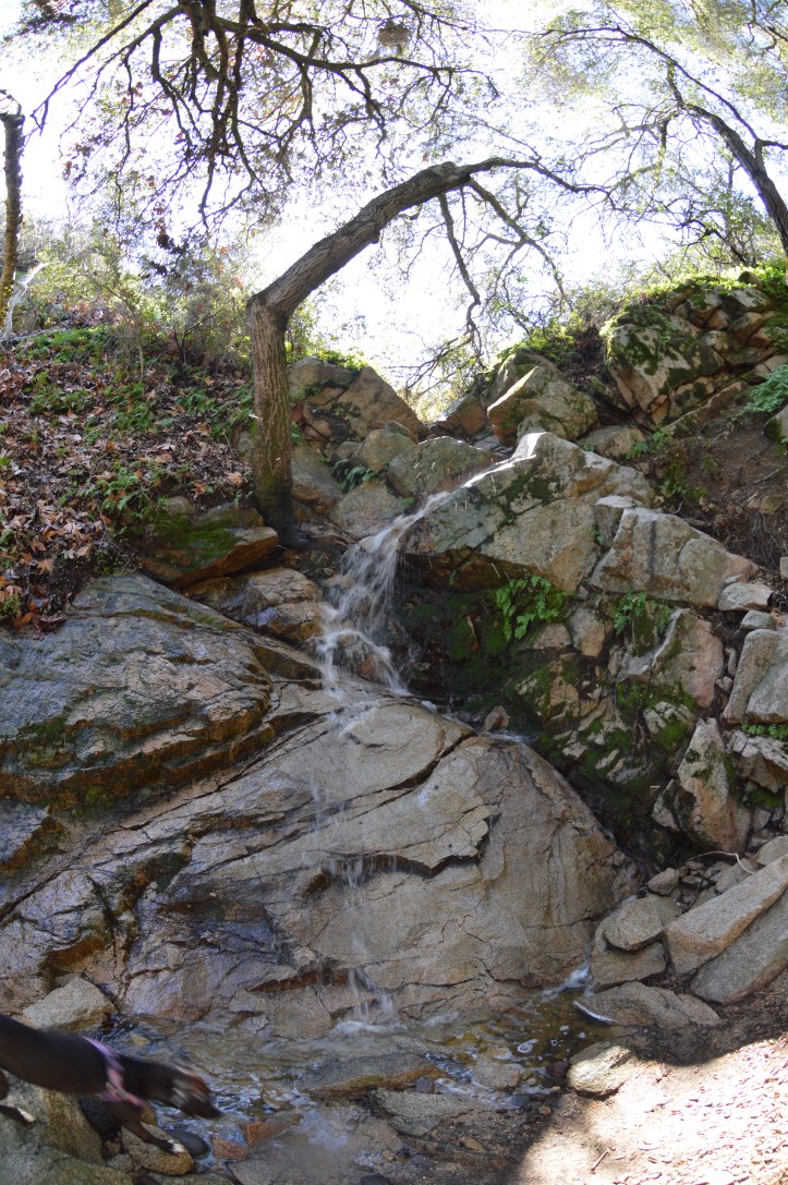
As you descent elevation back into the tree covered creekside trail you stumble across the first hidden beauty of the trail. The thing is, you think you’ve reached Tenaja Falls. Only this waterfall doesn’t have the graffiti from the pictures you’ve seen. This waterfall isn’t open to sunlight and it’s covered in beautiful green moss and while it’s not nearly as big as you expected it to be it is much majestic.
Hopefully you’ve figured out your mistake by now and have either turned around or just rolled with the punches and kept walking. If you kept walking you’d come across a couple more smaller waterfalls. Each is beautiful and different. There is one switchback in this trail and takes you from one habitat to the next. I hope you brought your mosquito net and tick repellent because the bug activity is thick.
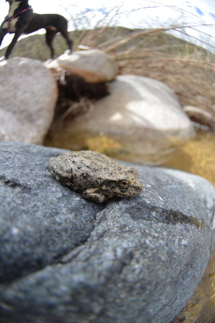
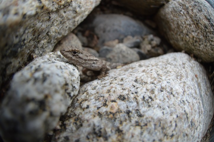
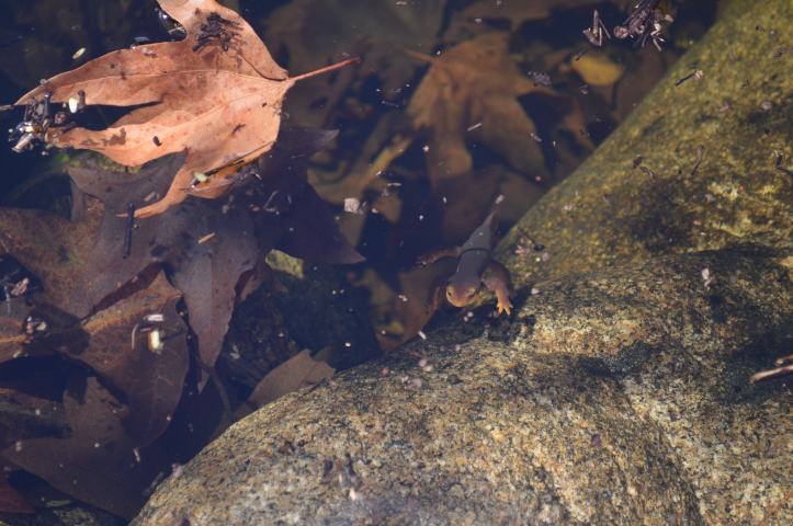
As the trail opens up and drops you off creekside and a local “secret” hippy location, Joint Boulder. This is a great spot to take a break and refuel. Back on trail, you start to notice the poison oak everywhere. You’re concerned but ‘fuck it’ let’s push forward. 2 epic creek crossing provide the opportunity to really absorb the situation you’ve put yourself in. Look close and you’ll see small frogs, salamander, big frogs, lizards, and REALLY BIG FROGS.
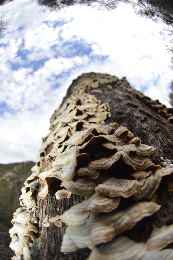
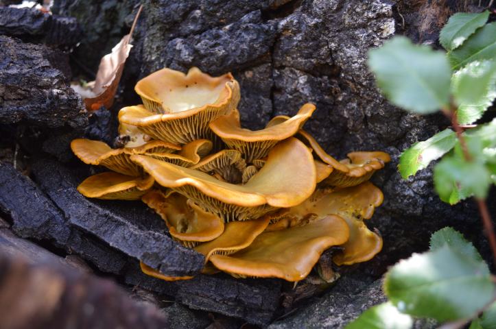
As the forest sucks you back in you notice the several different species of fungus eating away at the trees. Only for that fungus to be eaten by a fungis-eating-fungis. You notice scat from local ‘pumas’ on the scat rock, a rock in the middle of the trail that’s usually covered in puma scat. Once again the trail opens up and you’ve reached the second major junction of the San Mateo Canyon Wilderness, Fishermans Camp.
From here you can take the San Mateo Trail to BlueWater or to Four Corners. You could take the trail to the falls OR take the upper trail to the Fishermans camp parking lot. Either way your adventure takes you, read the trail head map first..